Lake Elsinore, California, January 2014
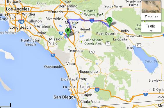
Jan 24 - the tripAfter a reasonably pleasant airport and flight experience, we landed in Palm Springs, hopped into our rental car, grabbed some lunch at Sherman's Deli, and drove to the thriving metropolis of Lake Elsinore, about 1 hour away. The reason for this drive: just because. We like the Palm Springs airport - as airports go. Lake Elsinore has a Best Western with very reasonable rates. Lake Elsinore has a bunch of walking trails. Yep, it's not a big tourist zone - wonderful! Just our kind of place to unwind for a couple of weeks. This map shows the basic geography - and so many of the places that we have visited before: San Diego, La Jolla, El Cajon, Santee, Poway, Palm Springs, and Indio. I guess we have to admit that we like southern California!
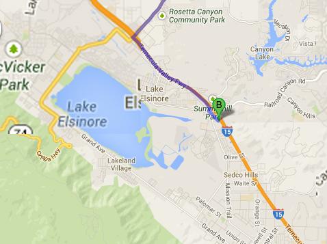
We drove northwest of Palm Springs, and then south and west to Lake Elsinore. This Google Maps shot shows the local area - the lake and where our hotel is.
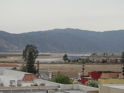
This shows the view of the lake from the hotel:
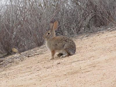
Of particular interest is the fact that we asked for both a ground floor room and a room with a view of the lake. We didn't realize, then, that the ground floor is actually more like a walk-out basement room, with a fairly minimal view of the lake. Yes, the hotel is a few meters above the lake level, but it would be really pushing it to consider this to be a "view of the lake". After settling into our room (which opens out to the swimming pool area - Stephen likes this!), we went for a stroll of the neighbourhood. Mainly, we went to a grocery store to pick up some take-out stuff for supper. On the way back to the hotel, we came across this bit of wildlife - much smaller than the rabbits that inhabit our condo complex in Calgary. And no, I didn't tilt the camera - it really was on a serious slope.
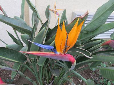
And along the hotel, some Bird Of Paradise plants - those flowers are just gorgeous.
|
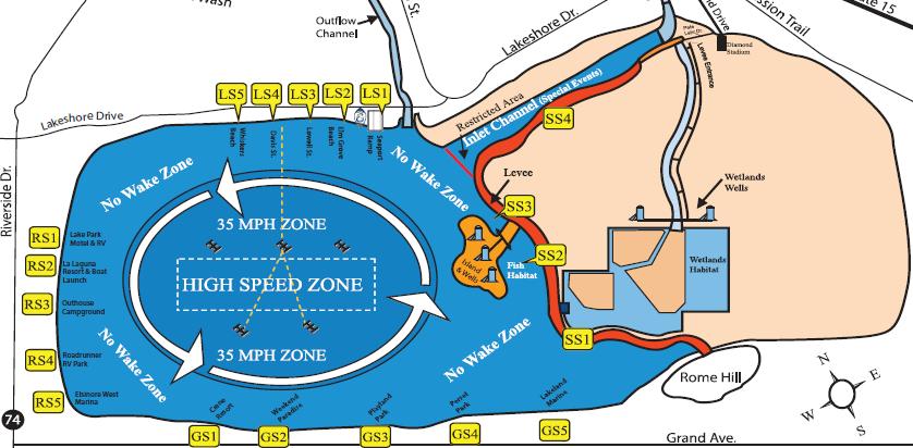
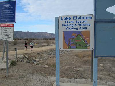
Jan 25 - Lake Elsinore LeveeLast night, we discovered information about this place, which is not too far from our hotel - like, we could see the levee from our room. The city's website indicated that the levee was about 3 miles long. So I did the math, and decided that I could manage a 10 km walk - that's pretty well at my limit, but it looked really flat. First, the map from the city's website. The red blob is the levee that we aimed for.
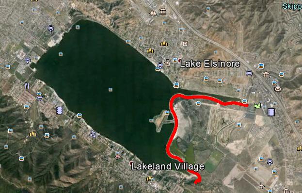
And here is the Google Earth view of our stroll. The red line is my track.
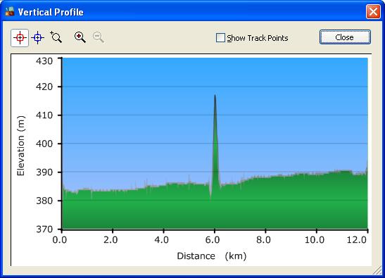
But this elevation profile shows the real details - including how long our little hike was. I'll talk about that spike a bit later
|
|
After figuring out where we could park (at the local baseball stadium), we drove to the appropriate place. It's always a comfort to see a sign that says we are where we want to be.
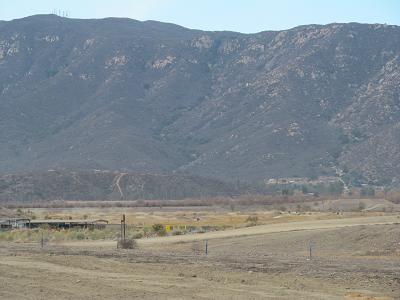
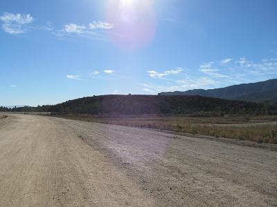
Off in the distance, we could see a small hill that appeared to be Rome Hill, shown on the bottom of that city map. More on that later.
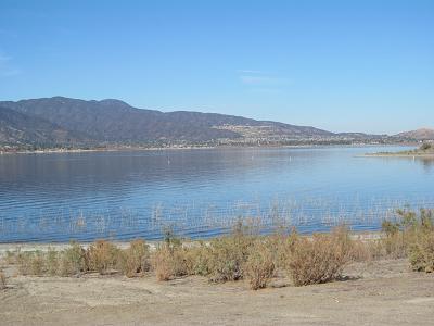
Of course, what we really wanted to see was the lake. Here are a couple of shots.
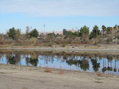
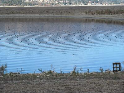
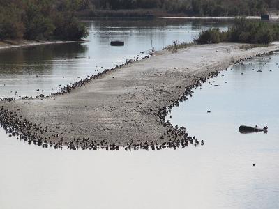
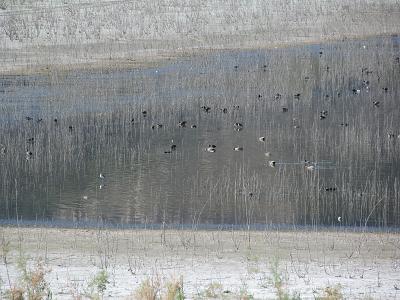
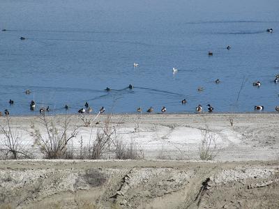
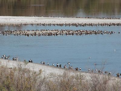
The trail meandered around a wetlands habitat. This meant that we saw lots and lots of birds.
|
|
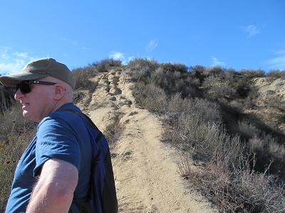
At the end of the levee, somewhat after the 3 mile mark (so much for my 10km calculation), we came to Rome Hill. For normal people, this would have been a good turn-around point. Especially if that normal person was one whose arthritic knees had already walked more than 5 kms.
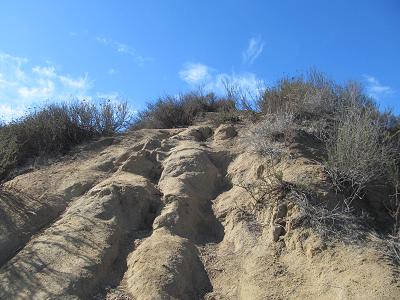
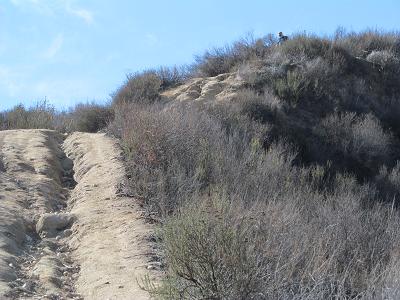
But we're not normal! Because there is a geocache at the top of the hill. After lengthy debate, during which we discussed the quality of what appeared to be the best trail to the top, we started ascending. About 2/3 of the way up, the more sensible one of us (ok, the one that was hurting more) thought that a turn-around might be in order. The other one of us kept on climbing, aiming for the cache. These shots show what made me turn around.
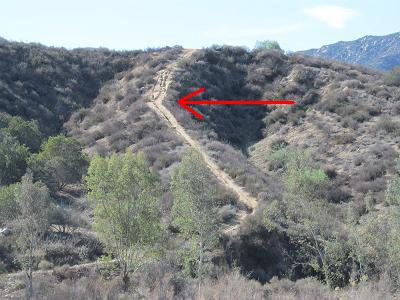
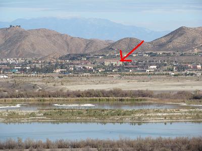
The red arrow on this photo, taken from a distance, shows about how far I went.
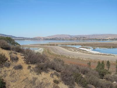
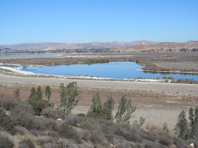
But before I turned around, I took these photos of the view from a bit above lake level.
The red arrow on this photo points to our hotel.
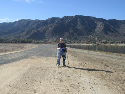
After hunting around a bit at the top, Stephen declared defeat - he couldn't find the cache within his standard 3 minutes, so down he came - passing me on the downhill, too (I really go slowly down hills, especially when they are slippery sandy). Anyway, that climb explains the spike in that elevation profile above. And this is me on the levee. I like having an I-was-here shot!
So we headed back to the car. When we were about 2 kms from the car, when my GPS said that we had gone 10 kms, I really slowed down. So I suggested that Stephen walk closer to his normal pace, head for the car, drive to the local Walgreens, pick up a cool drink or two, and theoretically by the time he returned to the parking spot, I would have arrived. Well, I was still about 100 m away when he returned. But he came to meet me with a cold drink, which was exactly what I needed then. So then he drove me back to the hotel, where I sat and computed. Four hours and 23 minutes of walking takes its toll on my knees. He went to the local Pizza Hut and brought back a pizza. Then he went to the grocery store to get some more bottled beverages. |
|
One of the, er, features of this hotel is that one of our neighbouring guests likes to sit on a bench close to our room and smoke a bit of marijuana. Interesting. And unpleasant, when the odor wafts into our room. Hmmm.
Another interesting feature is the collection of rat traps near all of the ground-level guest room doors. Hmmm. Tomorrow's activities have not yet been planned. |